Knowledgebase Article
Reading and Understanding the Sectional
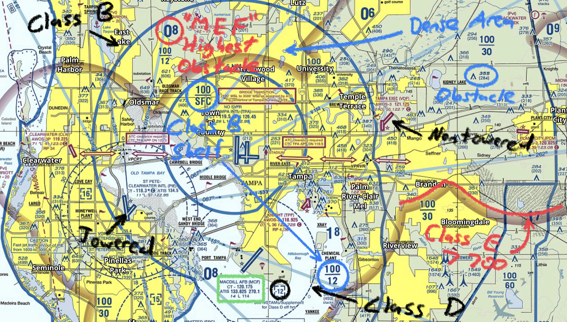
Sectional Aeronautical Charts are the primary navigational reference medium used by the VFR pilot community. The 1:500,000 scale Sectional Aeronautical Chart Series is designed for visual navigation of slow to medium speed aircraft. The topographic information featured consists of the relief and a judicious selection of visual checkpoints used for flight under visual flight rules. The checkpoints include populated places, drainage patterns, roads, railroads, and other distinctive landmarks. The aeronautical information on Sectional Charts includes visual and radio aids to navigation, airports, controlled airspace, restricted areas, obstructions, and related data.
Sectional charts are used primarily by VFR pilots, but are useful to all
pilots.
The FAA issues new sectional charts every six months and once a year for Alaska.
Decoding the Sectional
This FAA guide breaks down every symbol, icon, color, and feature of the VFR Sectional Aeronautical Chart. Use it as your bible while learning!
Here are some basics.